
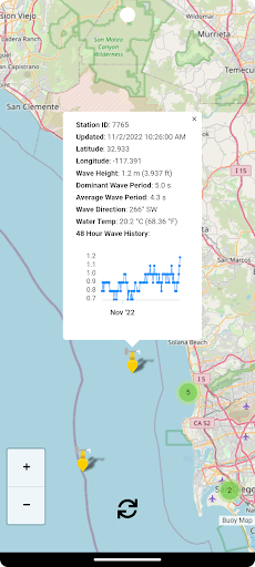
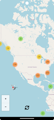
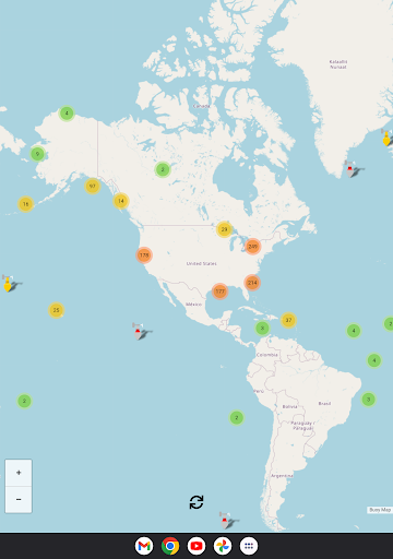
Features Buoy Map
A world map with live buoy data provided by the United States National Oceanographic and Atmospheric Administration (NOAA).
Updated every 30 minutes with the latest data, including last 48-hour wave height graphs.Buoy data includes (each buoy has a different set of instruments so not all sensors apply to every buoy):* Wind Direction* Wind Speed* Wind Gust Speed* Wave Height* Wave Height 48 Hour History (Graph)* Dominant Wave Period* Average Wave Period* Wave Direction* Air Pressure* Air Pressure Trend* Air Temperature* Water TemperatureI plan to add new features frequently and I hope that you find this app helpful.
Suggestions and constructive criticism is welcome.Enjoy!
Weather Features
Get accurate weather forecasts and real-time updates.
Food & Dining
Discover recipes and order food from your favorite restaurants.
News & Updates
Stay informed with the latest news and updates.
See the Buoy Map in Action
Get the App Today
Available for Android 8.0 and above